I just got back from a short bike ride - a ride that started two months ago and took me from the Canadian border all the way to Mexico. You can read more about my motivation and see dispatches from my trip at http://greatdivideride.blogspot.com
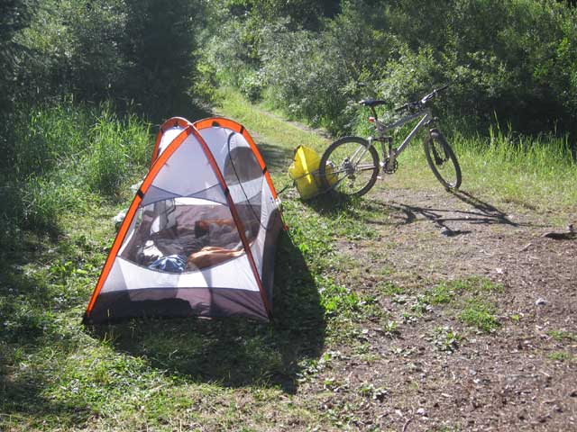
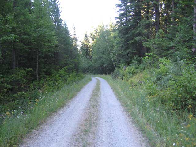
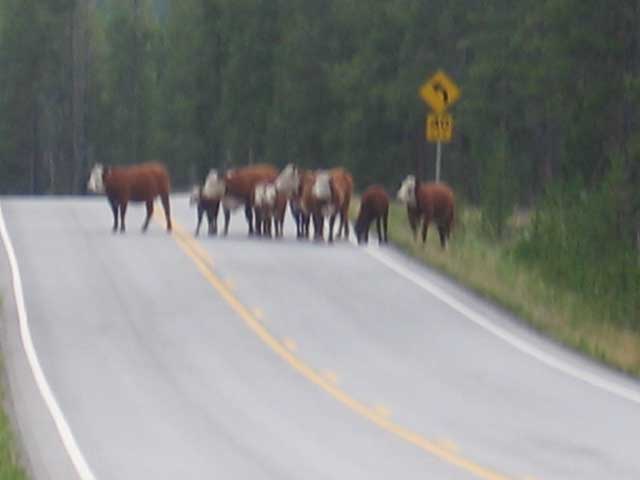
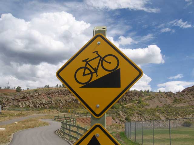
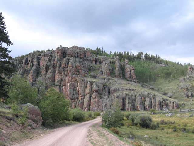
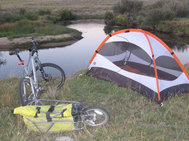
day 1 - Port of Roosville to 'Sons of Rest' slide - (august 1st, 2005)
34.65 miles - 5:34 hours - 6.2 avg.
summary: my first day; tons of mixed feelings: excitement, loneliness, happiness, anxiousness; huckleberry
milkshake in Eureka; not making the days recommended mileage; setting up camp for the first time
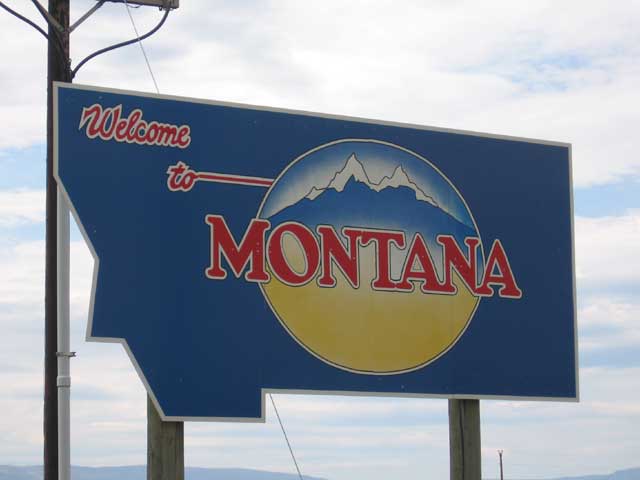
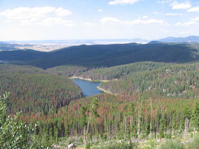
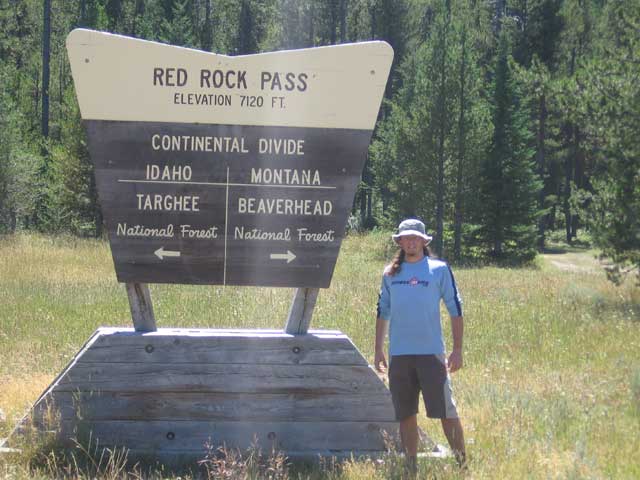
'welcome to Montana'" - only 2,500 miles to go
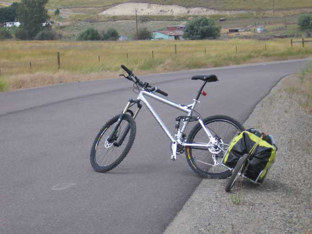
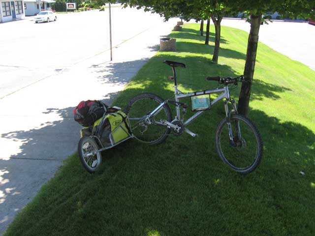
my bike and gear all shiny and clean
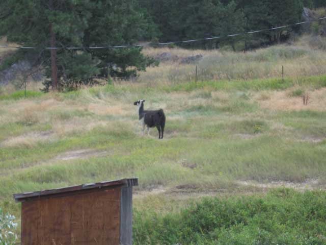
my first 'wildlife' sighting - a lone llama
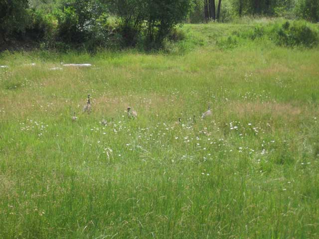
wild turkeys lurking
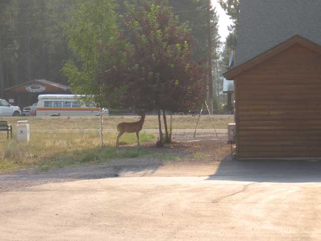
the first of hundreds of deer i would see
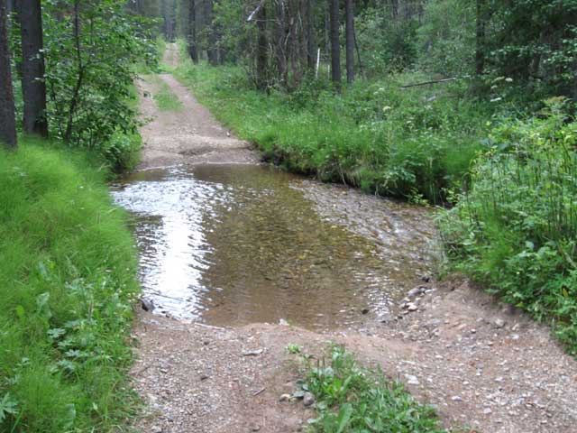
day 2 - 'Sons of Rest' slide to Red Meadow Creek
39.84 miles - 6:42 hours - 5.9 avg.
summary: rare early start; filtering water successfully (which made me confident that i
could rely on myself and i wouldnt die out in the woods); fast, rocky descent; not sleeping
on the side of the road; feeling sick and considering giving up
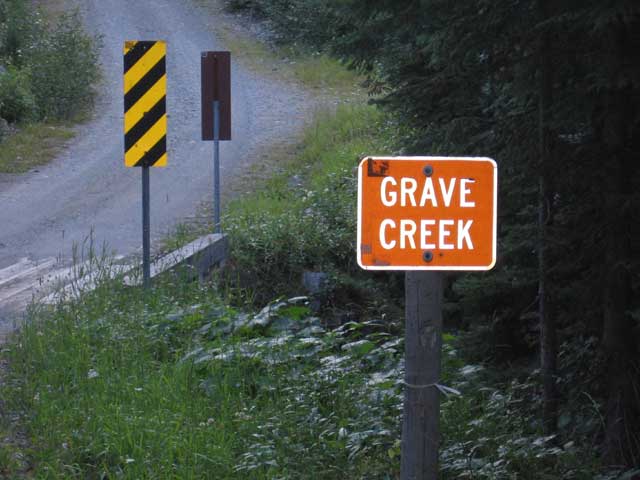
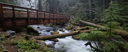
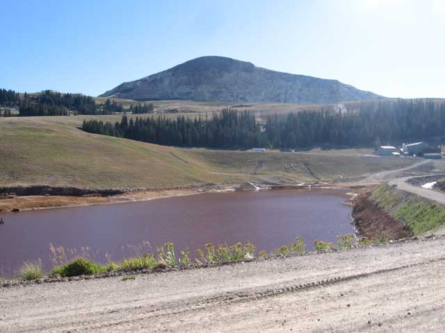
Grave Creek - my first water source
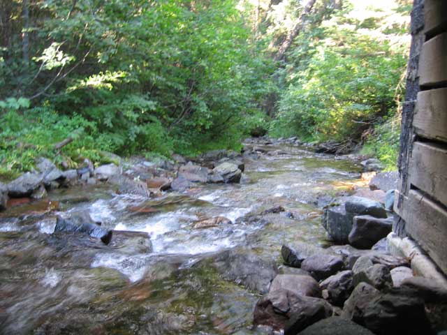
cool view from under the Grave Creek bridge
day 3 - Red Meadow Lake to Whitefish, MT
33.92 miles - 4:23 hours - 7.7 avg.
summary: red meadow lake was gorgeous; only having a single snickers bar to eat all day;
long descent into Whitefish; having a pizza and a beer at a restaurant; deciding that i
could do this
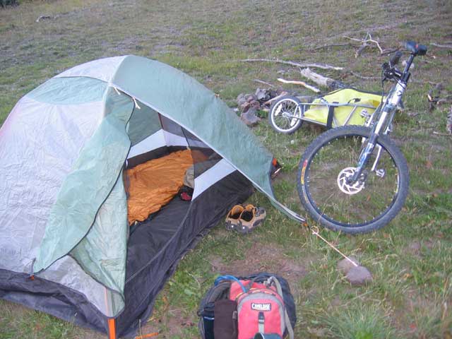
my minimalist campsite
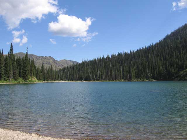
situated high in the forest, Red Meadow Lake was beautiful
day 4 - Whitefish, MT to Bigfork, MT
45.59 miles - 5.23 hours - 8.4 avg.
summary: hot sun and a nasty sunburn; dry, dusty gravel roads; first 40+ mile ride; fun trail
from Swan Lake to Bigfork; getting a real meal at the end of a hard day; camping (perhaps
illegally) in the city park
(no pictures)
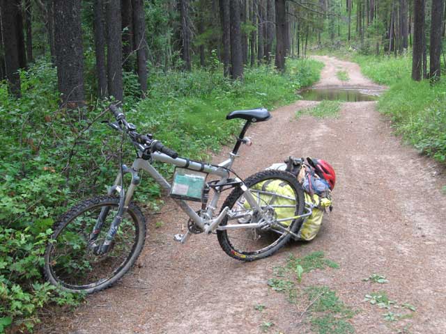
day 5 - Bigfork, MT to Fatty Creek Road
34.78 miles - 5.31 hours - 6.3 avg.
summary: hot day again; tough climb; fun descent; getting low on water; riding in the dark
because i couldnt find a good campsite
a biker-friendly family offered water, camping, and a rest stop for wary riders
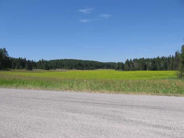
a field of brilliant yellow flowers
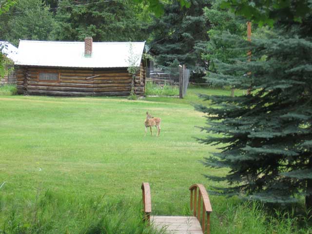
the only moose i saw on the trip
my bike taking a break in the shade
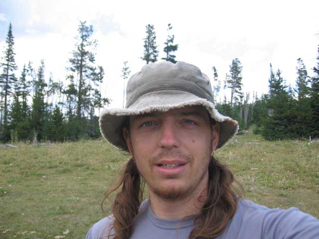
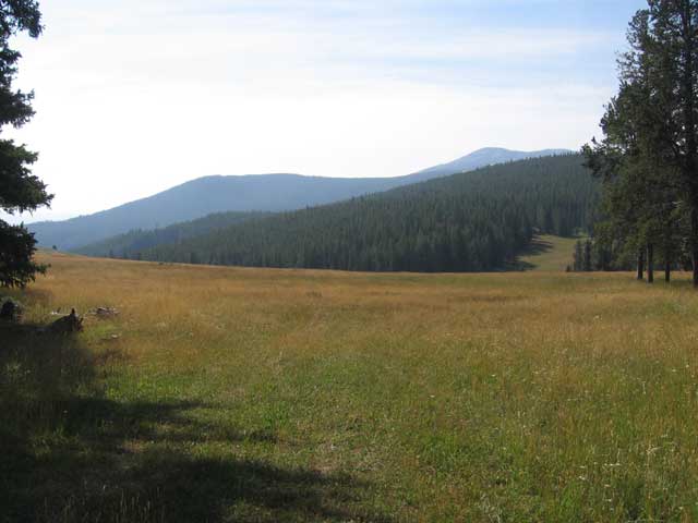
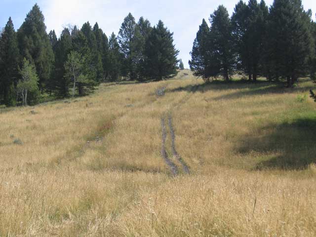
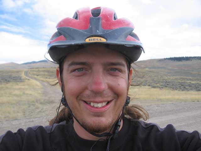
day 6 - Fatty Creek Road to Holland Lake
41.05 miles - 6:04 hours - 6.7 avg.
summary: awesome singletrack through forests and meadows; arriving at Holland Lake lodge only
to find that there was a private wedding there and no food was being served
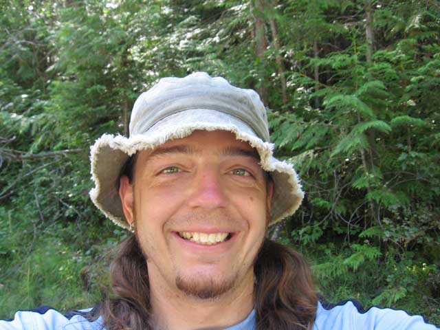
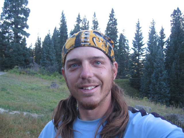
self-portrait (at the beginning of the day because i am still smiling)
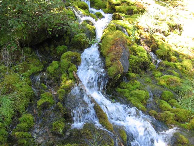
a cool mossy waterfall
a peaceful ride through the cool forest is not the worst way to spend a day
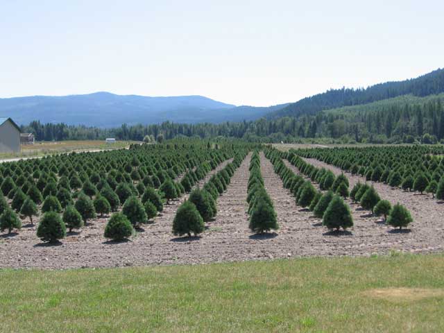
miniature christmas trees in training
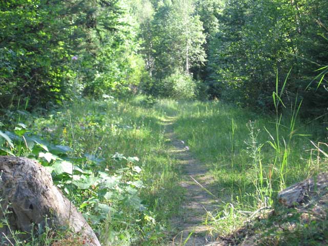
some great singletrack through the woods
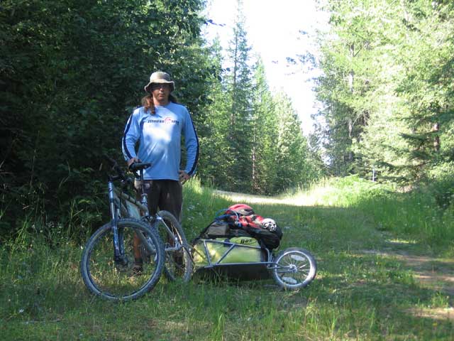
me and my bike getting ready to hit the singletrack
day 7 - Holland Lake to Seely Lake, MT
34.39 miles - 4:28 hours - 7.7 avg.
summary: first deviation from the mapped route; another huckleberry milkshake; bored with
seeing deer; sleeping under the stars
deer were everywhere, even right in town. i finally tired of taking pictures of them
day 8 - Seely Lake, MT to Huckleberry Mountain
45.27 miles - 6:18 hours - 7.1 avg.
summary: long day; resting in Ovanda (population: about 50, dogs: about 100); long gravel roads;
finding a hidden campsite; dreading a hard day tomorrow
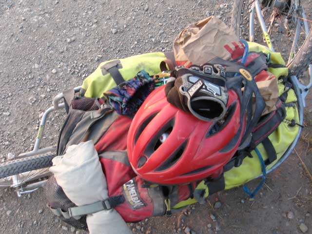
BOB carrying the load
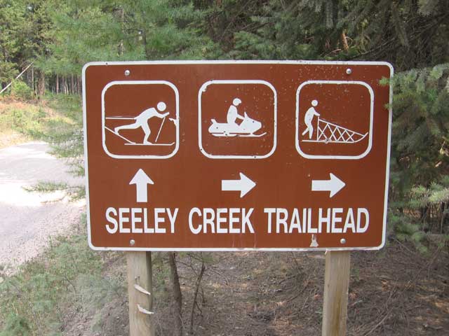
don't worry, dogsledding IS allowed on this trail
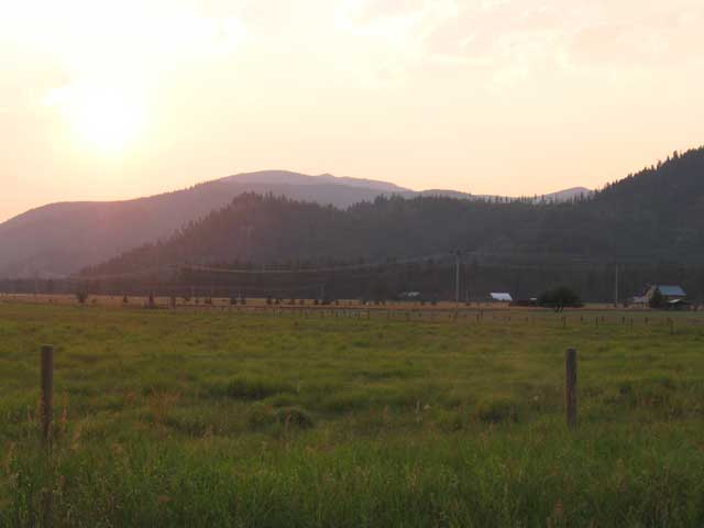
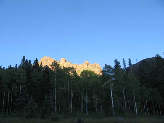
sun setting on the wide-open ranchlands of northern Montana
day 9 - Huckleberry Mountain to Lincoln, MT
26.86 miles - 4:20 hours - 6.1 avg.
summary: met a couple of young guys who worked for the forest service; 6-mile climb up Huckleberry
Mountain; finding out the climb wasnt so bad after all; incredibly bumpy washboard roads; finding
out Lincoln is the home of the Unibomber; choosing from an extensive menu of: hamburgers, cheeseburgers,
or bacon burgers
(no pictures)
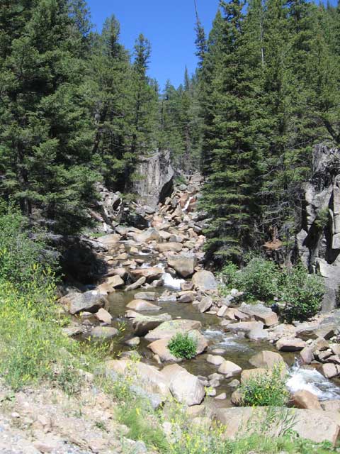
day 10 - Lincoln, MT to Deadman's Creek
30.23 miles - 4:45 hours - 6.3 avg.
summary: tough 4-mile alternate trail deep in the forest with several stream crossings; bear
sighting; first continental divide crossing; first time i got rained on; not finding the
recommended campsite; setting up camp in a place where i knew there were bears; playing the
harmonica; nighttime visit from a bear
an incredible stretch of trail, including 4 stream crossings
my bike and BOB taking a rest after crossing some streams
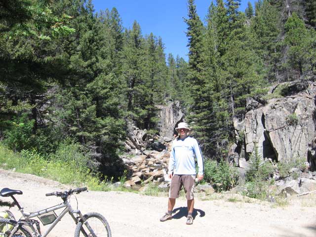
finally, my first continental divide crossing
a little worn out, but happy to have made my first divide crossing
day 11 - Deadman's Creek to Helena, MT
35.74 miles - 5:35 hours - 6.4 avg.
summary: super early start; vowing to never visit Deadman's Creek again; first taste of riding
into the wind and on pavement; getting a hotel room and taking a shower
(no pictures)
day 12 - Helena, MT
REST DAY
summary: cloudy and rainy; having to decide to take an unplanned rest day; spending most of
the day sitting in a restaurant
(no pictures)
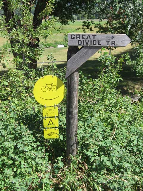
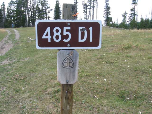
day 13 - Helena, MT to Park Lake
23.04 miles - 4:49 hours - 4.7 avg.
summary: looking forward to a super short day; feeling more tired after a day off; walking up
a majority of a tough climb; finding out that my recommended campground was closed because the
nearby dam had a crack in it
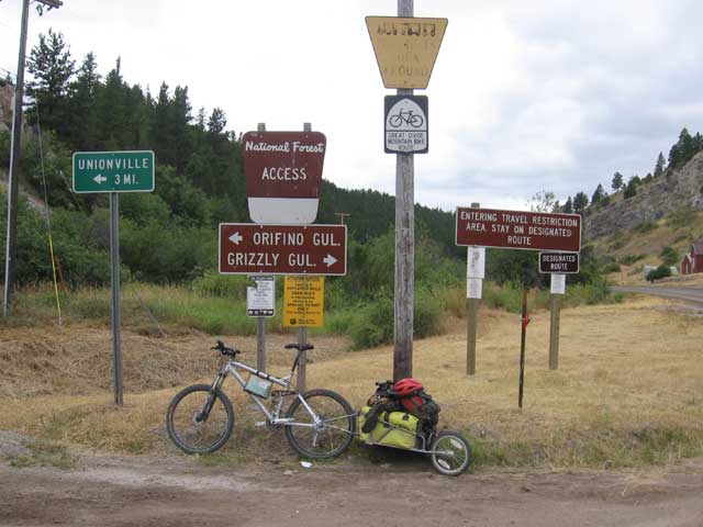
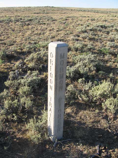
a few too many signs
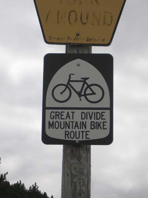
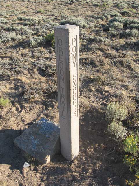
a cool Great Divide Mountain Bike Route trail sign
day 14 - Park Lake to Butte, MT
46.52 miles - 6:34 hours - 7.0 avg.
summary: very long day; 3-mile mostly hike-a-bike over Lava Mountain; ran into a group of 4-wheel
drives doing a trail run; awesome descent down Uncle Sam Creek canyon; lucking out that the only
restaurant in Basin was open on a sunday; non-maintained cattle access trail; taking a nap in the
middle of the ride; first bad taste of frontage roads; scary fast descent on the interstate into
Butte
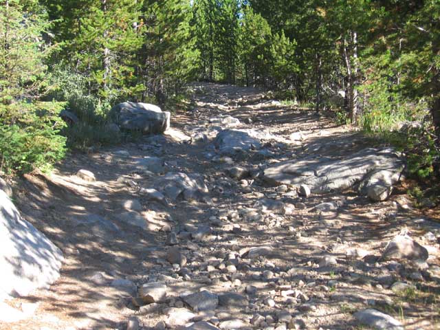
the Lava Mountain trail was rocky and steep and great mountain biking - if you arent dragging an extra 80 lbs. behind you
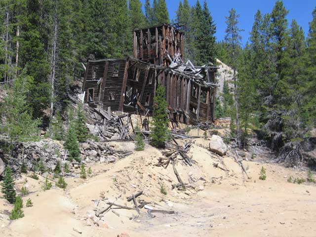
one of many old abandoned mines in Montana
a rocky and rugged mountain stream
me and the stream
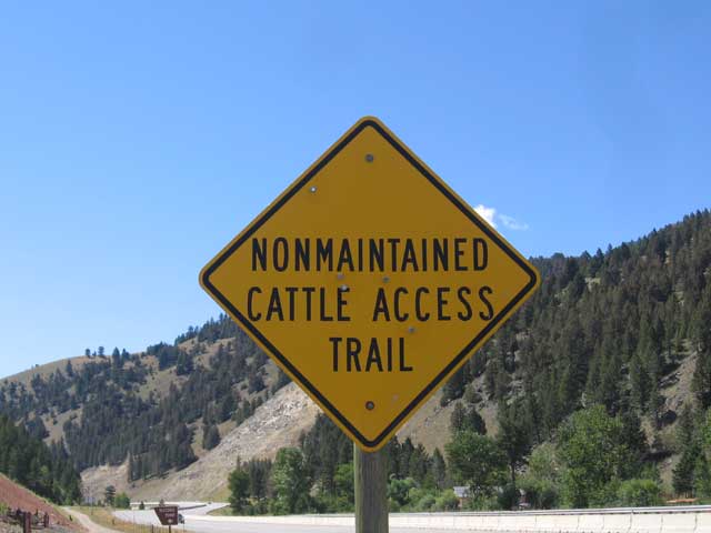
what exactly is a 'Non-maintained cattle access trail' anyway?
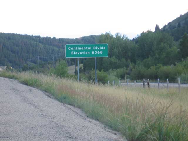
another divide crossing, with the elevation starting to creep up
day 15 - Butte, MT to Beaver Dam Campground
36.79 miles - 5:37 hours - 6.5 avg.
summary: having to replace my seat; another tough climb; laying on my back and looking at the clouds;
seeing an eagle; having to mentally and physically grind out the last 6 miles before dark; looking
forward to having other campers in the campground (not that i talk to them, but i found myself hoping
for their presence anyway)
overlooking Butte from up on high
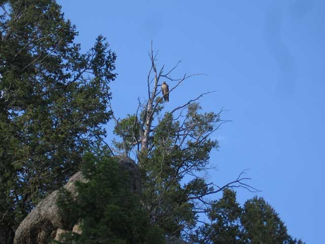
a golden eagle checking me out
day 16 - Beaver Dam Campground to Little Joe Campground
37.35 miles - 5:17 hours - 7.0 avg.
summary: super hard climb, including the first time the map instructed to 'push your bike up the hill';
deciding to try to ride the Fleecer ridge descent that the map warned against; finding out that BOB
is tricky on the super steep stuff because he has no brakes; feeling good after i rode the 'toughest
hill (up or down)' on the whole trail; meeting Steve & Agnes (and Emma the dog) and having a good
conversation with them
a forest meadow with a gorgeous view
the infamous Fleecer Ridge descent (waaaaaay steeper than it looks in this picture)
the real Montana street gang
day 17 - Little Joe Campground to Grant, MT
48.71 miles - 6:04 hours - 8.0 avg.
summary: Steve & Agnes' incredible generosity; missing out on a good downhill because of construction;
getting caught trying to avoid the pilot car; first ride in a vehicle in over 2 weeks; missing out on
a soak in the hot springs; little bit of refreshing rain; hammering it on the pavement; forging on
past my recommended campsite; finding an unexpected cafe in Grant; meeting Jack & Jim, two awesome
guys who even shared their room with me
long lonely road across southern Montana's wide open space
still looking rough, but happy
day 18 - Grant, MT to Lima, MT
70.09 miles - 8:44 hours - 8.0 avg.
summary: meeting some folks doing a faithful re-enactment of the entire Lewis & Clark expedition (including
building a ship and making dugout canoes, etc); being in the middle of nowhere; deciding to ride 2
days worth in one day
jim and jack, biking a Montana portion of the Lewis & Clark trail, loaded up and ready to take on Lemhi Pass
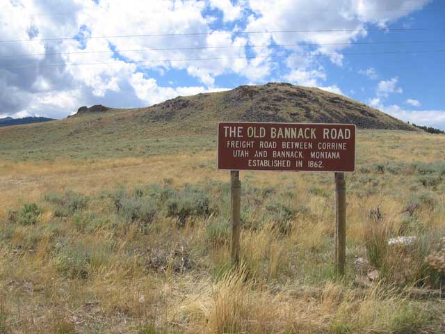
the Old Bannack Road in the middle of nowhere
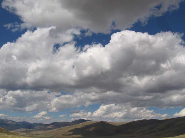
big sky is abundant in Montana
luckily, it only rained for about 15 minutes this day
day 19 - Lima, MT to Red Rocks Wildlife Refuge
57.77 miles - 7:22 hours - 7.8 avg.
summary: late start; lots of gravel; having to push it to get to my camp before it was too dark;
realizing i was getting much stronger
(no pictures)
day 20 - Red Rocks Wildlife Refuge to Island Park, ID
30.06 miles - 4:02 hours - 7.4 avg.
summary: seeing some Trumpeter swans (even if it was from a *very* far distance); completing my ride
through Montana and entering Idaho; seeing a bald eagle; Rob & Faye offering me a place to camp because
it got too dark to continue riding
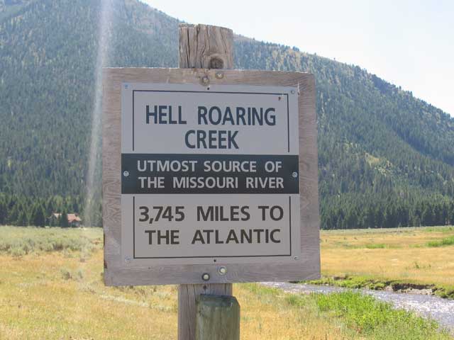
pretty cool to think that the water in this creek flows all the way to the Atlantic Ocean
20 days gone by and i had ridden through the entire state of Montana
day 21 - Island Park, ID to Warm River Campground
36.15 miles - 4:11 hours - 8.6 avg.
summary: soft, bumpy old railroad bed; realizing the book's description of this portion of the trail
as being 'tedious' was spot on; incredible views of the Warm River; the last section of the trail was
a fun descent with wildflowers and an old tunnel; being warned by the campground host to watch out for
skunks
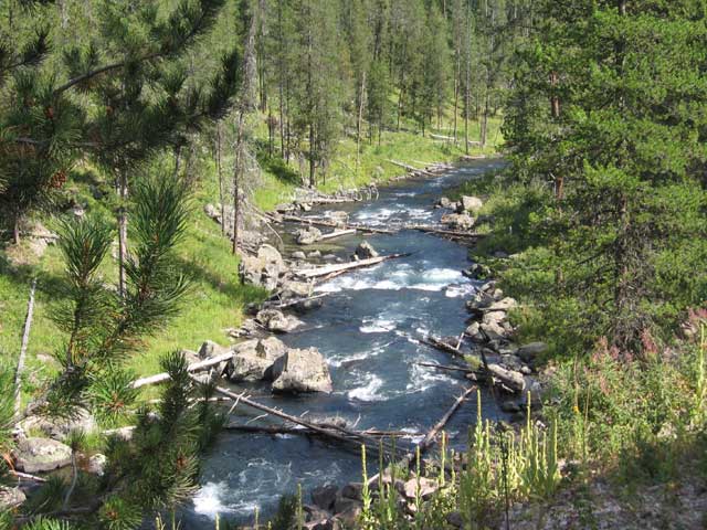
the last portion of the ride today had great views of the rugged Warm River below
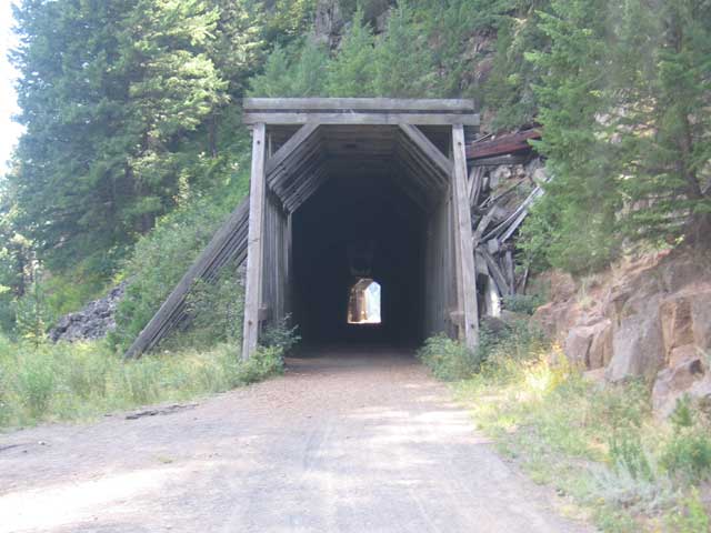
since the trail today followed an old railroad bed, i got to pass through this cool old tunnel
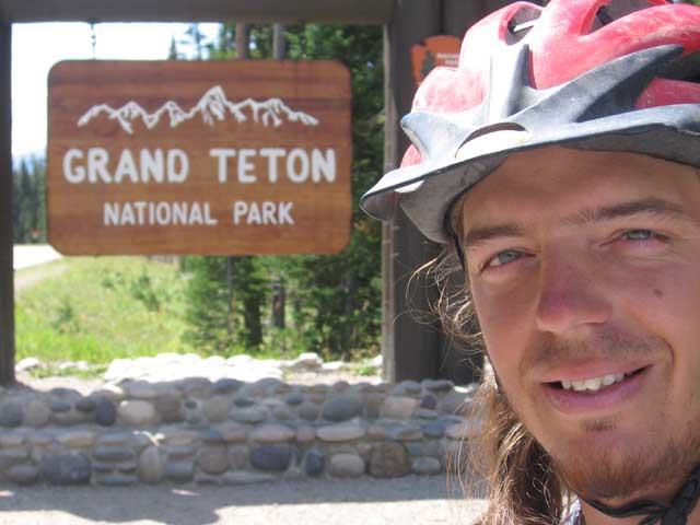
day 22 - Warm River Campground to Flagg Ranch, WY
48.45 miles - 6:36 hours - 7.3 avg.
summary: potato fields; unexpected lunch at Squirrel Meadows Ranch; first views of the Tetons; finishing
Idaho and entering Wyoming and not even knowing it; riding along the edge of Yellowstone; incredible
scenery; narrowly missing a wicked thunderstorm; meeting a couple from California at dinner who took
my picture and called my mom to tell her i was doing good
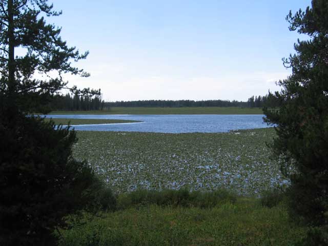
this big lake was about 90% covered in lily pads
day 23 - Flagg Ranch, WY to Togwotee Village, WY
45.09 miles - 6:54 hours - 6.5 avg.
summary: having to ride on the pavement all day; cars and RVs whizzing within inches of my handlebars;
stunning views of the Tetons; meeting a guy (Mike) riding the TransAmerica trail from Washington, DC to
Portland, OR; finding out that Blackrock Bicycle campground was non-existent; struggling up an additional
4 miles to Togwotee Village in the dark; having the best meal of the ride and an ice cream sunday to
top it off; having to find my campsite and set up camp in the pitch black
even though i had to ride on the road most of the day, the road ran through Grand Teton National Park so it was very scenic
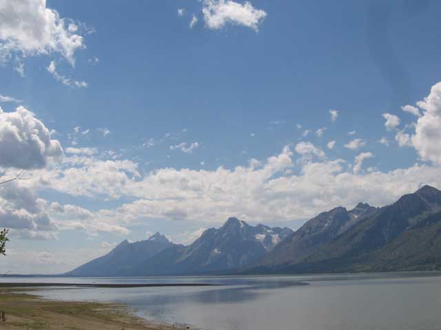
the Tetons literally rise straight up from the lake below, no foothills at all
some good advice
day 24 - Togwotee Village, WY to Union Pass
43.11 miles - 6:26 hours - 6.7 avg.
summary: losing my rain jacket; finding my rain jacket; looooong climb up Togwotee Pass; meeting a family
from France who had a son who had riding his bike around the world and trekked across Africa; fast
descent on pavement; climbing the 2nd pass of the day; wind that almost blew me over; turning down a
ride up the hill; finding an awesome primitive campsite
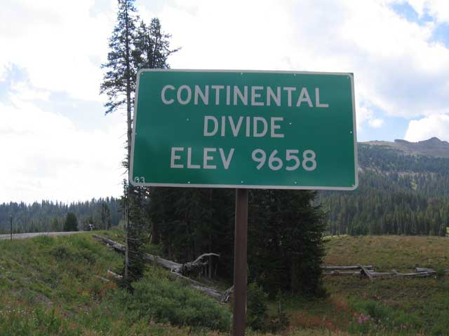
yet another divide crossing, elevation still going up, up, up
day 25 - Union Pass to Cora, WY
40.86 miles - 5:37 hours - 7.2 avg.
summary: more wind; feeling a little bit sick; finding the tree carving from the first group to ride
this trail; skipping my campsite to find some real food; stumbling upon 'The Place' restaurant
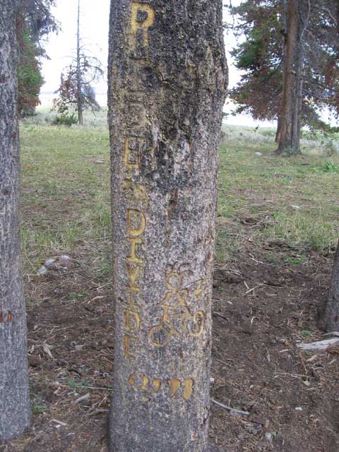
the first group to ever ride this route carved this back in 1998
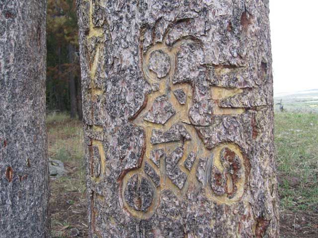
the hair is close, but i wasnt going that fast

this is what i would look like if you were only two inches tall
day 26 - Cora, WY to Pinedale, WY
28.88 miles - 2:48 hours - 10.2 avg.
summary: short ride; trying to see how fast i could go; finding out that all of the hotel rooms were
booked by oil companies who were drilling in the area; finally finding a family-run hotel tucked in
by a creek that held their rooms for tourist only (no oil employees); feeling like i went back in time
in the local grocery/sporting goods store
(no pictures)
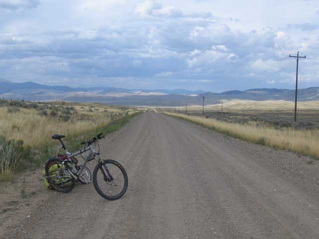
day 27 - Pinedale, WY to Little Sandy Creek
50.57 miles - 6:18 hours - 8.0 avg.
summary: headed out for a 135-mile stretch through the Great Basin desert; running into two seperate
people looking for a lake in the middle of the desert; meeting Mike & Birdie, two Californian hippies
who had just sold their house and were touring around the country living out of their camper; setting
up camp in the dark
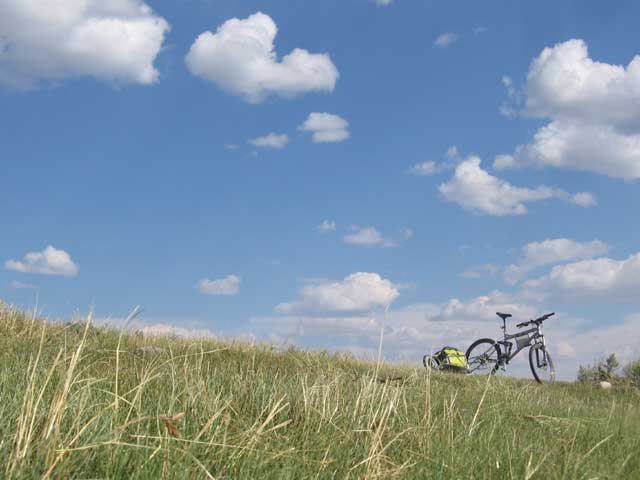
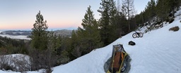
headed into the Great Basin
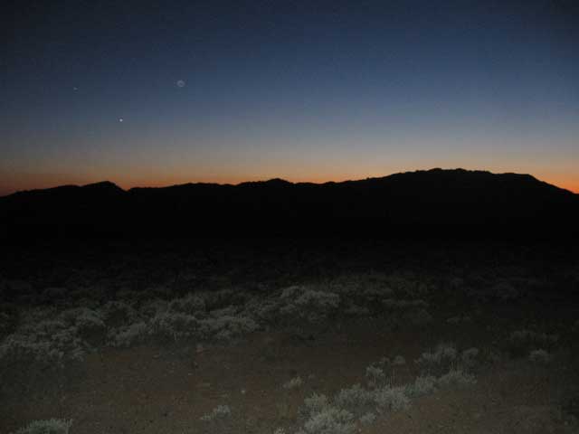
nightfall in the desert
day 29 - Sweetwater River to Rawlings, WY
116.31 miles - 15:46 hours - 8.4 avg.
summary: long day riding through the desert; no water sources for 70 miles; more wind; deciding
to skip the cow-patty campground and continue riding to (what i thought was) a town; seeing
a herd of wild horses; finding out my 'town' was just a single condemned-looking building;
stupidly deciding to try to continue to Rawlings even though it was dark and 33 miles away;
running completely out of water; contemplating just lying down and dying on the side of the road;
watching the cars tail lights keep going up and up the never-ending hill; finally getting to
Rawlings at 2:15am; being super dehydrated; getting a room at a super sleezy looking motel;
deciding to quit my ride
lots of history running through this area
this picture doesnt show it, but you could still see the old wagon ruts from the original trails
day 30 - Rawlings, WY
REST DAY
summary: trying to recover from yesterday; spending the day in the library reading about rivers and
canoe-camping; deciding to try to keep going with my ride
(no pictures)
day 31 - Rawlings, WY to Middlewood Hill
32.56 miles - 4:51 hours - 6.7 avg.
summary: struggling with the ride right from the start; deciding to just try to do 30 of the 55 miles
planned for the day; incredibly steep gravel hills; trying to hide my campsite because i didnt know
if it was private property or not
(no pictures)
day 32 - Middlewood Hill to Routt National Forest
56.46 miles - 8:03 hours - 7.0 avg.
summary: more climbing; finally getting back into the forest and out of the desert; a complete stranger
offering me all of his ice water; Aspen Alley; private property everywhere; trying desperately to get
back onto public lands before dark; getting too dark to even ride my bike; having a guy (Peter - the
chef at the huge guest ranch down the road) stop to make sure i was doing alright and help me set up
my camp
(no pictures)
day 33 - Routt National Forest to Steamboat Springs, CO
43.48 miles - 5:12 hours - 8.3 avg.
summary: single-minded vision on making it to Steamboat Springs today; very steep climb; enjoying
cold water while watching the hummingbirds; finding out that 'all down hill' isnt; some good
nachos at Hahn's Peak cafe; passing a hiker; arriving in Steamboat Springs - my unofficial
halfway point (actually, just past halfway); re-meeting the hiker from earlier in the day and
having him offer me a spare bed in his hotel room; hearing stories of hiking in the Alaskan
wilderness
(no pictures)
day 34 - Steamboat Springs, CO
REST DAY
summary: laundry; meeting Dan who wanted to sell his house in Florida and come ride with me; hanging
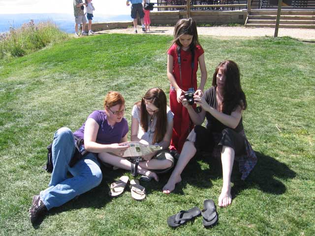
out in the park most of the day; getting to see Michaleen for the first time in over a month
(no pictures)
day 35 - Steamboat Springs, CO
REST DAY
summary: riding the gondola up the mountain; relaxing in the grass; chinese food; making marshmallow-
roasting sticks; sitting on the porch in the rain; roasting marshmallows over my pathetic excuse for
a fire
relaxing at the top of the gondola in Steamboat Springs
day 36 - Steamboat Springs, CO to Lynx Pass
42.28 miles - 6:15 hours - 6.7 avg.
summary: fun ride along a creek; crossing a dam; some singletrack around the lake; the bridge
being out; noticing bike tracks and wondering if i would meet someone else doing the ride;
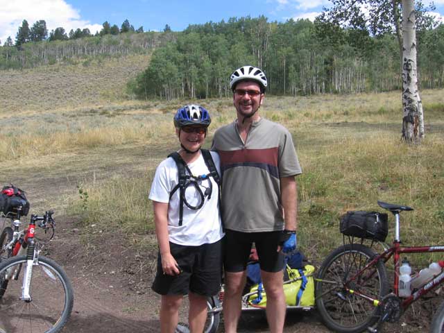
meeting Craig & Sheri who were riding from Steamboat Springs to Winterpark
(no pictures)
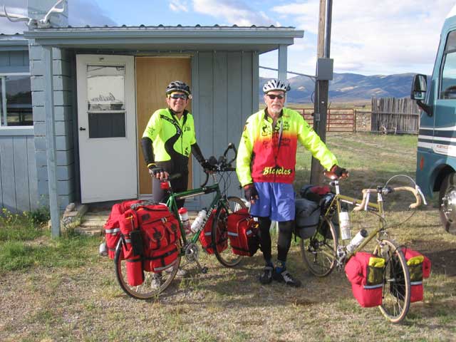
day 37 - Lynx Pass to Kremmling, CO
34.21 miles - 4:32 hours - 7.1 avg.
summary: late start; wondering if i would catch up to Craig & Sheri; fording a deep stream;
meeting up with Craig & Sheri again; enjoying riding with some people to talk to; some tough
hills and then a steep descent; lunch on the Colorado River; dreading a big hill; helping
Craig & Sheri hitch a ride into town; hammering the remainder of the ride before dark;
Craig & Sheri borrowing the hotel's van to come back and get me; Craig & Sheri renting a
cabin with an extra pull-out bed so i had a place to stay; steak dinner
craig and sheri - they were doing a 5-day bike tour along this portion of the route from Steamboat Springs to Winterpark
day 38 - Kremmling, CO to Blue River Campground
45.76 miles - 5:37 hours - 8.1 avg.
summary: saying goodbye to Craig & Sheri; long climb up Ute Pass; fast descent down pavement;
stopping short of my destination because i was beat
(no pictures)
day 39 - Blue River Campground to Frisco, CO
16.84 miles - 2:04 hours - 8.1 avg.
summary: eating pizza for lunch; riding the awesome bike path from Dillion to Frisco; getting
rained out; spending the day in the Frisco brewpub; talking to the locals about how cool it is
to live there; getting a hotel and hoping the weather tomorrow was better; shortest day so far
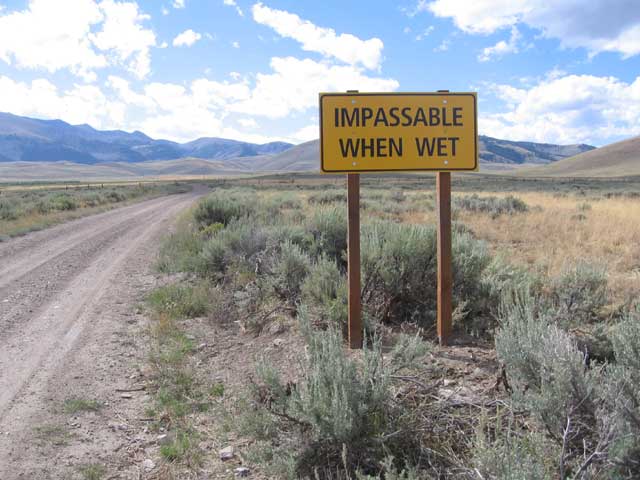
this sign totally sums up my trip
day 40 - Frisco, CO to Hartsel, CO
51.37 miles - 6:24 hours - 8.0 avg.
summary: early start; riding through the forest in the morning was awesome; the bike path from
Frisco to Breckinridge was fun; finding out that the climb up 11,500 foot Boreas Pass was not
really that bad; getting rained on again; taking shelter in an old railroad car; getting a ride
down the mountain from a friendly ranger; setting the top speed of the ride (38.5 mph); first
taste of the flat, treeless areas of South Park; tons of wind; arriving in Hartsel to find out
that the only restaurant in town only serves food until 4pm; camping in the back lot of the local
bar with dogs barking all night
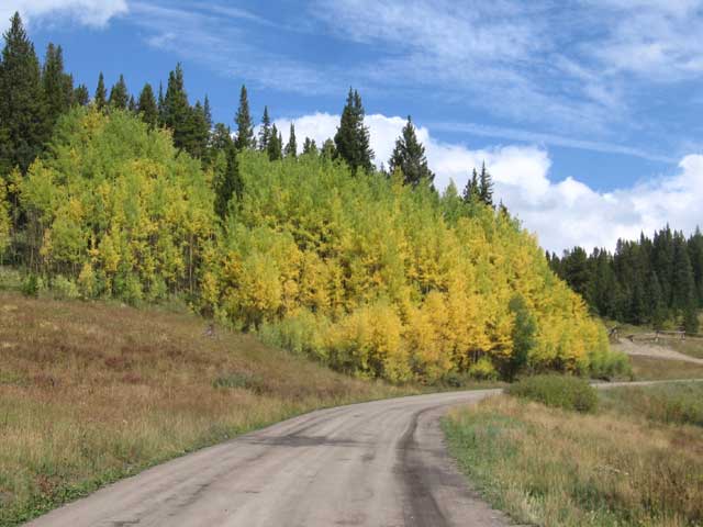
the aspens were starting to turn and the scenery was beautiful
day 41 - Hartsel, CO to Salida, CO
48.13 miles - 6:58 hours - 6.9 avg.
summary: more wind; hating wind; more boring areas of Colorado; super fast descent into Salida; Scot
at Absolute Bikes fixing up my bike, giving me tips on where to eat, and offering to let me stay on
their back porch; falling asleep to the jazz coming from the place next door
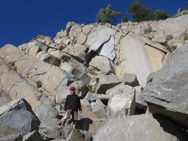
just me and some rocks
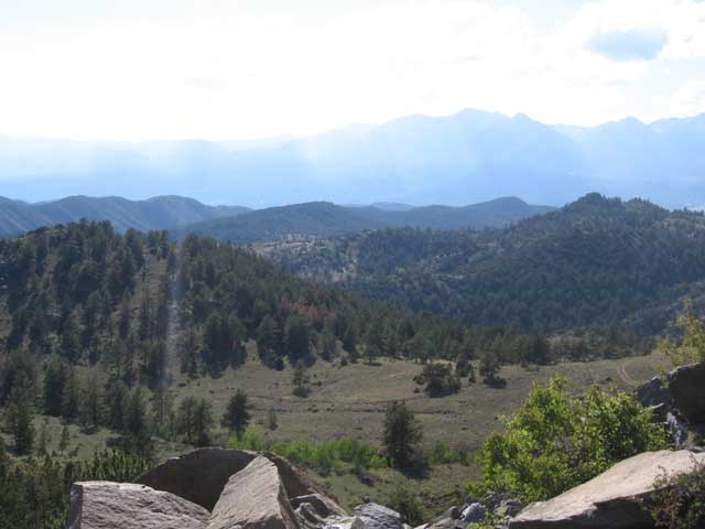
kind of hard to see, but these are the Collegiate Peaks, a bunch of 14,000 ft. mountains
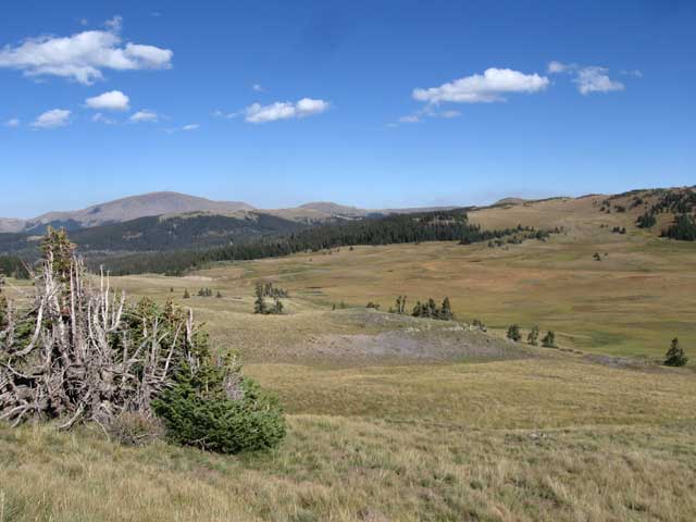
day 42 - Salida, CO to Marshall Pass
33.27 miles - 5:15 hours - 6.3 avg.
summary: big, long pass that ended up being not too bad to climb; crossing the Colorado Trail; starting
to plan my next adventure (kayaking trip); weather is starting to get cold at night
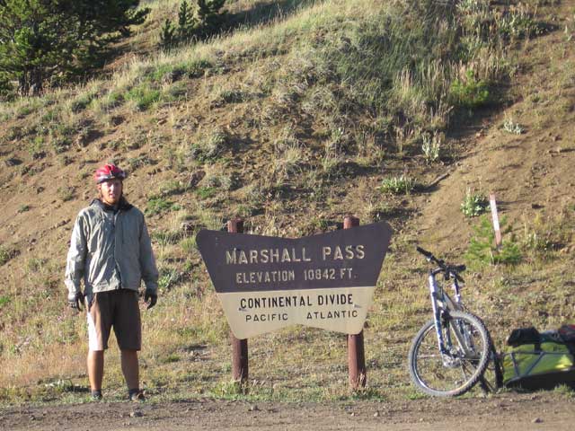
note the elevation, still going up. it was getting a little chilly up here as well
day 43 - Marshall Pass to Dome Lake
47.18 miles - 6:00 hours - 7.8 avg.
summary: more !@#$% wind!; exotic animal ranch with white elk, reindeer, and yaks
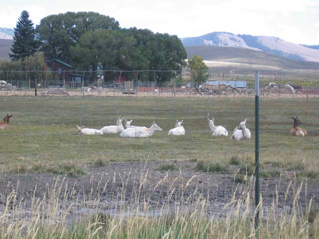
white elk
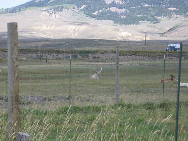
another white elk
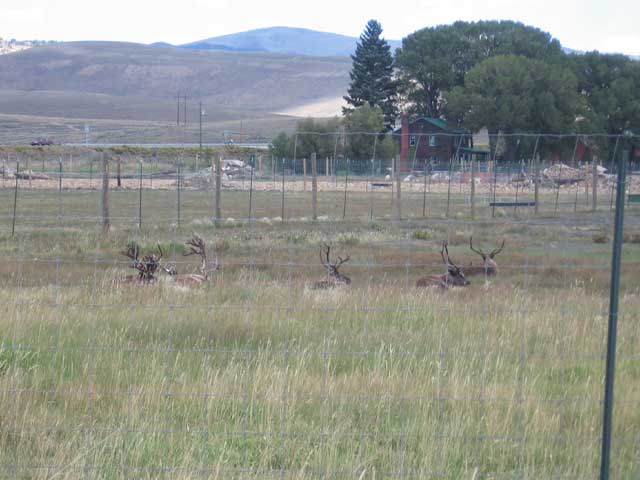
reindeer
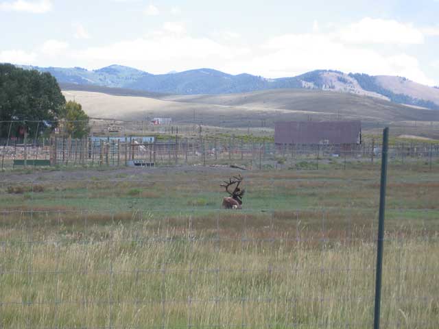
another reindeer
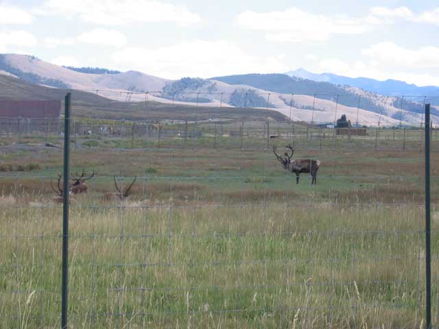
last reindeer
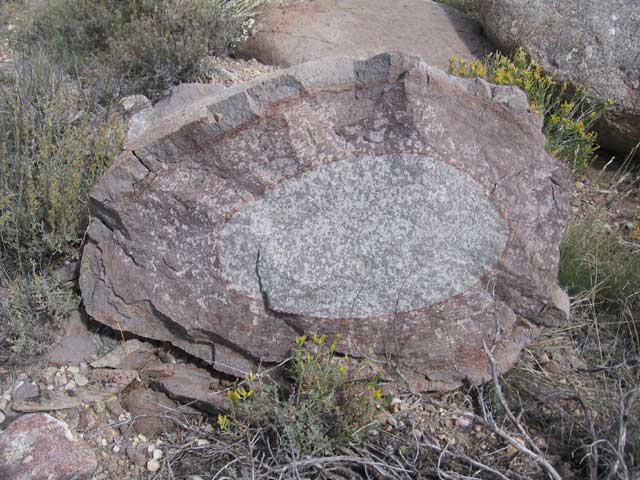
this rock had rings, almost like the rings in a tree. i thought it was cool
day 44 - Dome Lake to Storm King Campground
41.04 miles - 5:35 hours - 7.3 avg.
summary: back into the forest finally; climbing two 10,000+ ft. passes (Cochetopa and Carnero); over
1700 miles already ridden
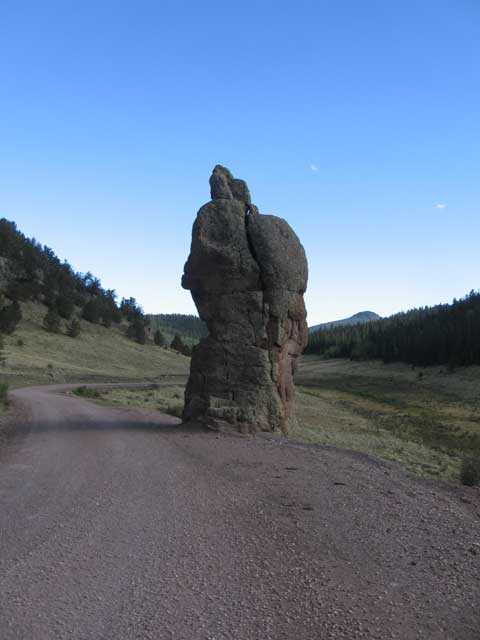
this area had some really neat rock formations
more cool looking rocks
day 46 - Del Norte, CO to Stunner Campground
42.28 miles - 7:01 hours - 6.0 avg.
summary: big day - had to climb up 11,900 foot Indiana Pass; for being the biggest hill of the trip, i
just slowly and surely rode up it; contaminated Summitville; trying to get to camp before dark; getting
really really cold on the final descent
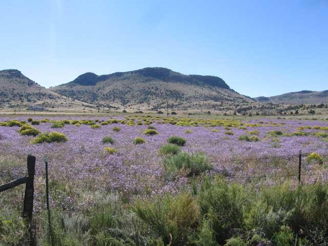
purple and yellow flowers in a field
the highest point of my trip, and no sign! 11,900 foot Indiana Pass
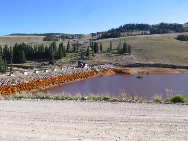
the Summitville area is all contaminated from decades of mining. it was pretty evident from the color of the water
hard to see here, but over half of that mountain in the background has been mined away
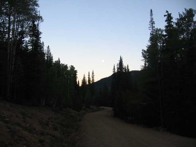
riding through the forest at night is one of the coolest feelings in the world
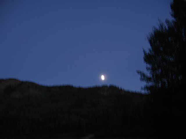
just the moon
day 47 - Stunner Campground to Platoro, CO
6.76 miles - 1:07 hours - 5.9 avg.
summary: shortest ride of the trip; the wind was fierce and that made it very cold as well; warming
up by the fire at the Platoro Cafe; the incredibly nice lady that ran the lodge offereing me a free
room for the night ("its going to go empty anyway" she said); warm peach cobbler with ice cream (x2)
(no pictures)
day 48 - Platoro, CO to Colorado/New Mexico border
37.65 miles - 4:41 hours - 8.0 avg.
summary: more wind (notice a pattern?); chicken and broccoli fettucine in Horca; last night in Colorado
my last night in colorado
obligatory mug shot
some sunny mountains
day 49 - Colorado/New Mexico border to Cuba, NM (off-route)
85.41 miles - 8:40 hours - 9.8 avg.
summary: bummed that i wouldnt get to see the Cumbres & Toltec coal engine; ending up getting to
see it anyway; long downhill into Charma; deciding to take an alternate route to Cuba because of
potential rain, bypassing Abiqui and cutting up to 3 days off my ride; feeling guilty about taking
the alternate route; finding out there was a big fire near Abiqui and feeling better about my route;
pounding the pavement for the first half of the ride; pushing past my intended campsite; surrounded
by private property and nowhere to camp; riding through the dark, hoping each little spot on the map
might be a town; deciding to ride all the way to Cuba; making it to Cuba in time to have a great
dinner at a Mexican restaurant
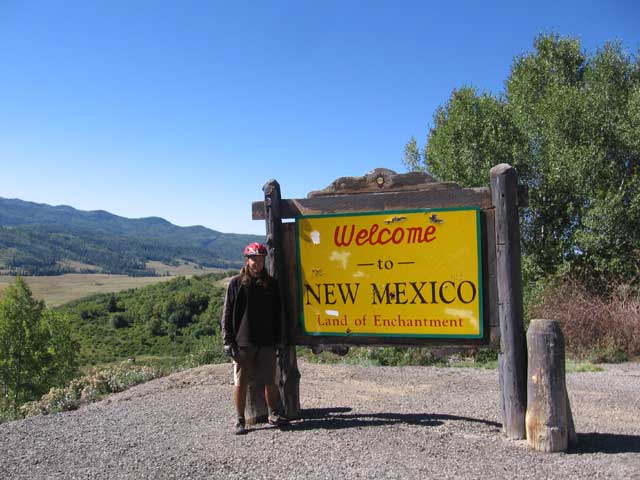
only one more state to go!
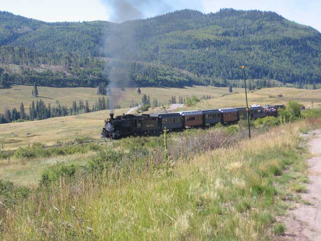
the Cumbres & Toltec locomotive chugging up Cumbres Pass
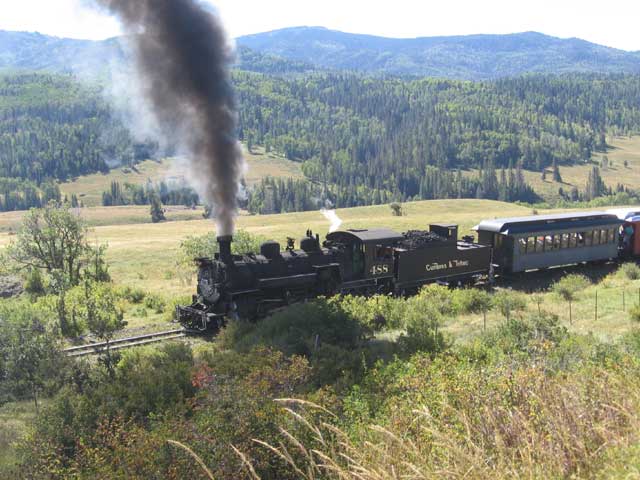
there is actually a guy in there shoveling coal as fast as he can to keep the train going. sometimes they have to try two or three times to make it up the pass
day 50 - Cuba, NM to Whitehorse, NM
53.49 miles - 5:43 hours - 9.3 avg.
summary: not looking forward to 2 long days of riding on the pavement; getting a tip on an off-road
alternate to my already alternate route; riding across the reservation with no idea where i am going
and no map to tell me how to get there; hiding my campsite just in case i wasnt supposed to be there
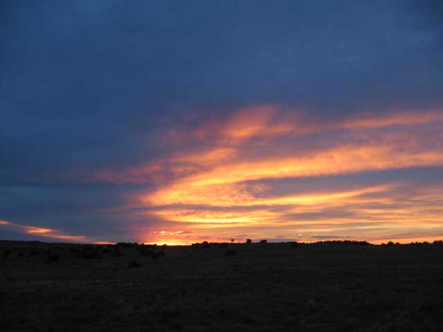
an amazing sunset over the Navajo reservation
day 51 - Whitehorse, NM to Grants, NM
59.66 miles - 5:52 hours - 10.1 avg.
summary: just racking up the miles on the pavement; starting to think about the end of the trip;
chinese food for dinner
(no pictures)
day 52 - Grants, NM to Homestead Canyon
45.69 miles - 5:04 hours - 9.0 avg.
summary: starting a 6-day stretch between Grants and Silver City; met a guy hiking the Continental
Divide who had left the Canadian border on June 13th; cool scenery; just enjoying the ride and not
looking at my odometer
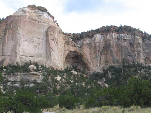
La Ventana ("The Window") natural arch in El Malpais National Monument
day 53 - Homestead Canyon to Pie Town, NM
31.99 miles - 4:08 hours - 7.7 avg.
summary: looking forward to the famous Pie Town; met another guy hiking the CDT; ate lunch and two
pieces of pie as i watch it start pouring rain right after i got inside; lost my fleece sweatshirt;
found my fleece sweatshirt; spent the afternoon relaxing
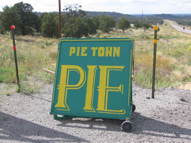
Pie Town, serving up...pie
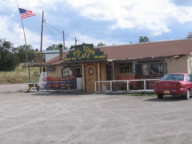
The Daily Pie, where i got some...pie
day 55 - Gila National Forest to Wall Lake
58.85 miles - 6:58 hours - 8.4 avg.
summary: long day; 'small reservoir' water source listed in the book turned out to be a big mud puddle;
way out in the middle of nowhere, wondering if maybe i took a wrong turn; finding out my intended
campground no longer existed; riding in the dark; falling asleep to elk bugling
(no pictures)
day 57 - Rocky Canyon Campground to Silver City, NM
44.05 miles - 4:45 hours - 9.2 avg.
summary: last big climb of the trip; met a guy who had ridden the trail on a motorcycle (cheater) =);
fun zip down the Mimbres River canyon; hot climb up the Georgetown road; first flat tire just as i
rode into Silver City
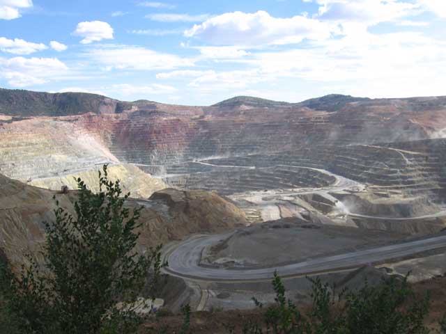
the Santa Rita pit mine - this picture doesnt represent how increbibly *huge* this thing is
day 58 - Silver City, NM to Hachita, NM
80.95 miles - 8:21 hours - 9.7 avg.
summary: another flat tire just after leaving Silver City; finally getting off of the pavement; riding
through the desert; trying to ride as fast as i could to make it to Hachita before dark; free beers and
a place to stay thanks to the owner of the only business in Hachita
(no pictures)
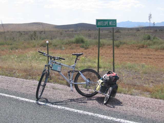
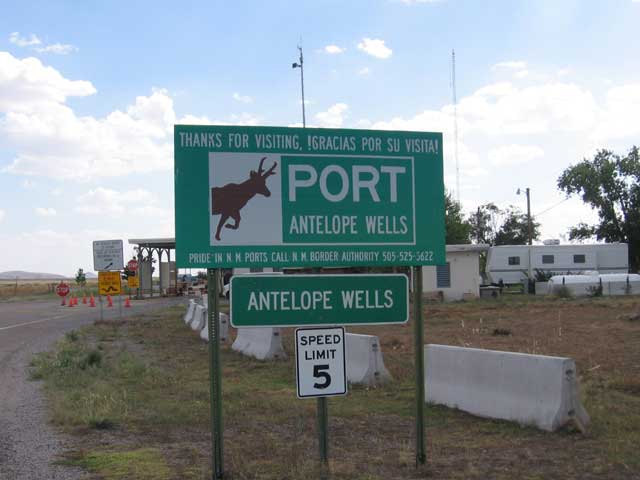
day 59 - Hachita, NM to Antelope Wells, NM - (september 28th, 2005)
46.11 miles - 4:36 hours - 10.0 avg.
summary: dilly-dally start; trying to ride slow; nothing but flat road ahead and sagebrush in every
direction; two flat tires at the same time (all four flats were in the last 3 days of my ride);
reminiscing on the trip; counting down the final miles; arriving at Antelope Wells; seeing Michaleen;
heading home
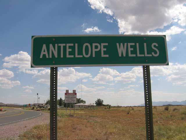
i had been waiting to see this sign for almost two months
my bike and BOB get all of the credit
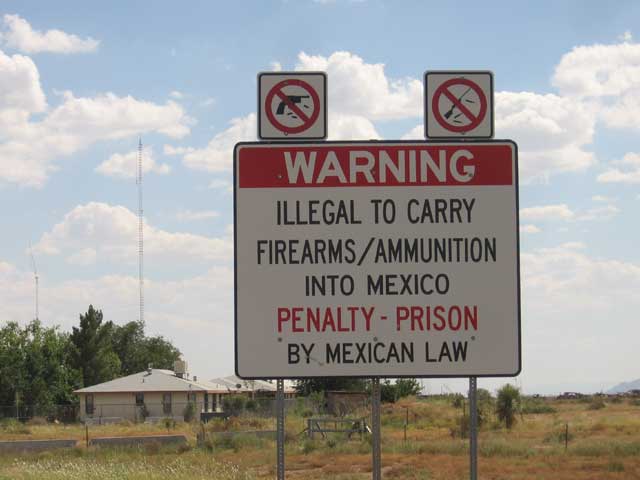
penalty: prison!
de nada
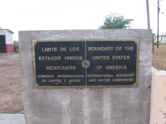
US/Mexico border
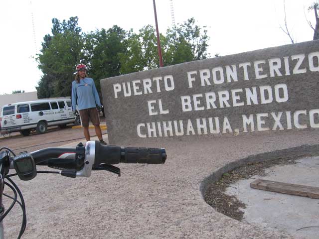
a very short trip into Mexico
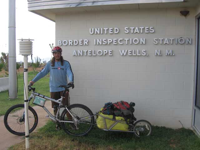
Antelope Wells - i made it!
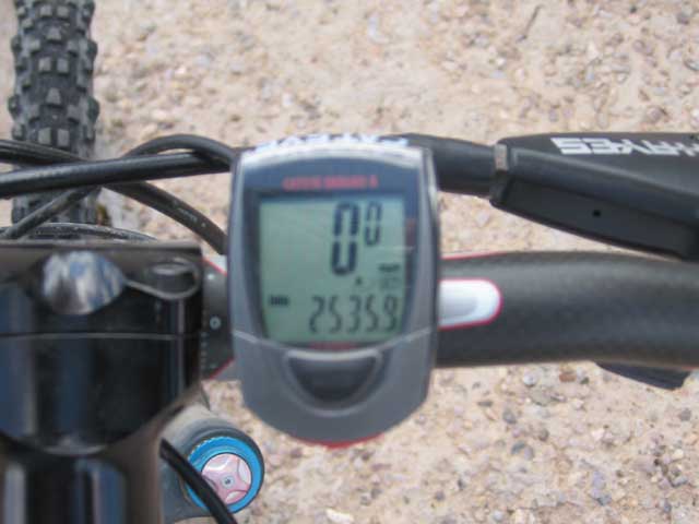
all in all, i rode 2401 miles (my odometer already had 134 miles on it when i started)
final stats:
2401 miles - 315:15 hours - 7.6 avg.
longest day: 116.31 miles (Sweetwater River to Rawlings, WY)
shortest day: 6.76 miles (Stunner Campground to Platoro, CO)
59 days, including 4 rest days

 @briandunnington